It is sixty miles from Seattle, closer yet to Tacoma and is the prominent feature on the horizon of this part of the State of Washington. Mount Rainier, also known as Tahoma, is an active volcano in the Cascade Range.
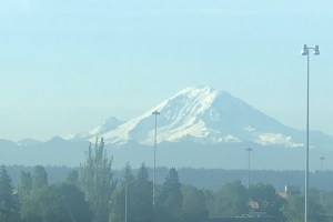
I took this pic from the highway near SeaTac Airport
Mt. Rainier is believed to have had some minor eruptions between 1820 and 1854, but these might have been merely rockslides or ash and pumice falls. Geologists think the most recent major eruption was in 1450 AD/CE.
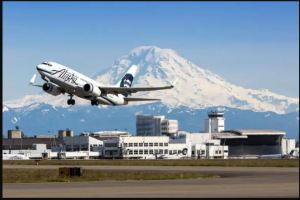
Another view of Mt. Rainer (courtesy Alaska Airlines)
Mt. Rainier is 14,400 feet high and is is the most glaciated peak in the contiguous lower 48. The threat of eruptions is real, and evacuation drills are in place for the immediate vicinity. The biggest threat is from lahars, volcanic mudflows that form when the glaciers melt. These volcano spawned mud slides destroy anything in their path.
