Central Ohio’s historic Sunbury town square

Sunbury is located near the actual geographic center of the State of Ohio. Founded in 1816, the then “village” was laid out in the classic New England town square design, with businesses  surrounding the square.

Town Hall, built 1848

A brief use history of the Hall

Different definition of pothead

American favorite of many


From its founding in 1816, Sunbury was designed to be a stagecoach town. Lawrence Myers, the town’s founder, built an inn at the intersection of two major stagecoach routes. The first stagecoach arrived in Sunbury from Mt. Vernon in 1820.

Civil War General

Detail of the statue


Horseman story

In 1848 the impressive brick Town Hall was constructed in the center of the square. It was first built two stories tall. Masons constructed the 3rd floor and occupied it for over 90 years. Multiple Ohio Historical Markers are placed around the  square providing information gems for the public.


War Memorial cannons in Sullivan Ohio

We were on the way from Columbus to outside Cleveland for a family gathering when Sher reached across me with her phone in hand. I rolled down the window, and the below picture is the result. This is at the intersection of US 224 and Ohio 58.

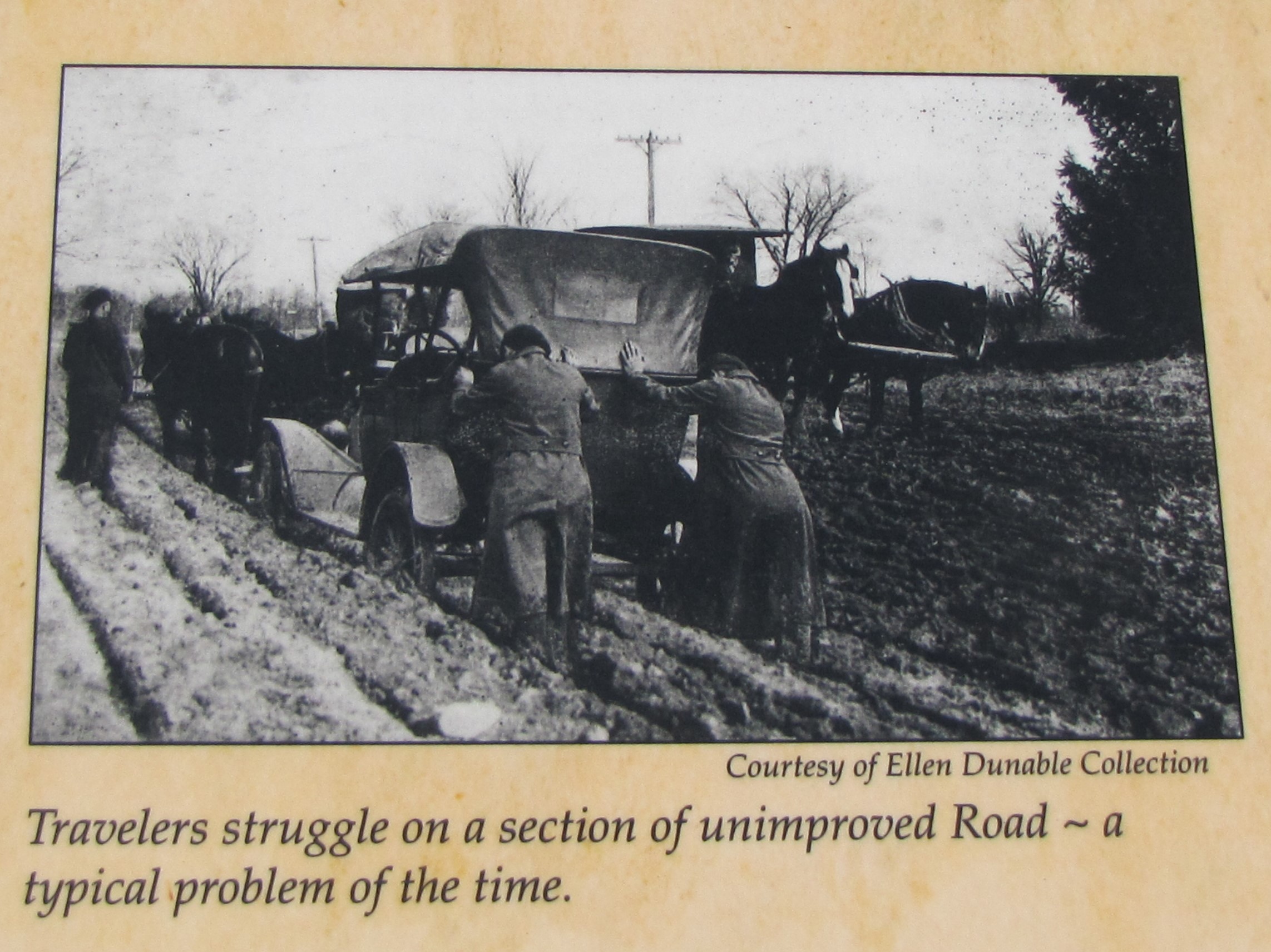
This is one of the many displays that are part of the National War Memorial Registry. These cannons honor the Revolutionary War, War of 1812, Mexican-American War, Civil War and the Spanish American War. Too bad we didn’t have time to stop.

National Road “modern improvements” in Ohio in 1916

Photo on the Eagles Nest Interpretive Marker showing travel on the National Highway

The Eagle’s Nest monument on the National Road (US 40) was erected around 1916 after a 29 mile stretch of the then unimproved and often nearly impassable road was replaced with concrete. The stretch of highway ran from Zanesville to Hebron and is east of Columbus. It is at the highest elevation of the road in Ohio.

Eagle’s Nest Monument, Interpretive Sign on right

The monument is a large granite rock with some interesting inscriptions carved into the surface. The photos show some of the details of the inscriptions, including a Conestoga wagon and mileage to Cumberland, Maryland, the starting point of the road. The completion of the experimental concrete stretch of the road led to a large parade when it opened.

Conestoga wagon etched into the granite

Ironically the day we stopped here the conditions were very muddy and wet. What a reminder of some of the early muddy conditions that the early travelers faced as they traveled across country.

You are 220 miles from the start of the National Road in Cumberland, MD.

A large interpretive sign was installed next to the monument in 2000. A well attended ceremony was held in a church near the site. You can visit the record of that ceremony here. This page displays the entire interpretive sign and other details.


Pedestrian traffic only on Stevenson Road Covered Bridge

Greene County , Ohio is a bit east of Dayton with pretty rolling hills and well kept farmsteads. This is also the home of the Stevenson Road Covered Bridge, now open to pedestrian traffic only.

View from the new road that bypasses the old bridge

Note the three members of the top chord

This beautifully restored bridge was originally built in 1877 by the Smith Bridge Company of Toledo. The design is designated a Covered Smith through truss. This design was patented by Robert Smith and utilized a system of multiple top and bottom chords depending upon span lengths and load requirements.

Vehicles were prohibited in 2003 with the road course moved in 2004. The bridge deck is 95 feet in length with a width of 16.5 feet. The bridge spans Massies Creek on Stevenson Road (CR 76) in Wilberforce.

This was the first Smith through truss bridge we had seen. While inspecting the bridge truss system, you notice several steel square pipe cross bracing supports. They did not look appropriate for the original structure. Photos on bridgehunter.com taken in 2015 do not show these steel braces, so these might have been added in the 2015 restoration mentioned on the entrance signage.

Note the rust colored steel angle and cross braces

View of the deck supports reflected in the water

Dates of interest

Sher enjoying this pretty bridge


The Stevenson Road Covered Bridge is a lovely addition to the history of Ohio, and to the countryside in which it stands. The approach is quite capable of safe vehicle parking allowing for easy and interesting access to the bridge and its surrounds. This is a stop well worth your time.


1916 era monument to National Road “modern imporvements” in Ohio

Photo on the Eagles Nest historic marker showing travel on the National Highway

Photo on the Eagles Nest historic marker showing travel on the National Highway

The Eagles Nest monument on the National Road (US 40) was erected around 1916 after a 29 mile stretch of the then umimproved and often nearly impassable road was replaced with concrete. The stretch of highway ran from Zanesville to Hebron.

The monument is a large granite rock with some interesting inscriptions carved into the surface. The photos show some of the details of the inscriptions, including a Conestoga wagon and mileage to Cumberland, Maryland, the starting point of the road.

The day we stopped here the conditions were very muddy and wet. What a reminder of some of the early muddy conditions that the early travelors faced as they traveled across country.


The Eagles Nest monument

The Eagles Nest monument

Conestoga wagon etched into the granite

Conestoga wagon etched into the granite

You are 220 miles from the start of the National Road in Cumberland, MD.

You are 220 miles from the start of the National Road in Cumberland, MD.