National Road US 40 vintage highway mileage signs

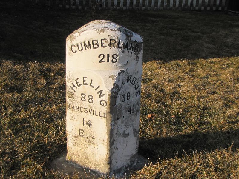
In 1806 an Act of Congress which authorized the construction of the National Road also stipulated that mile markers be installed at regular intervals. These reference sign posts helped travelers know that they were following the correct route. They also indicated the distances traveled and the distance to the next destination.

In Ohio there are several of these ” Mile Markers” information signs, explaining the mile posts that followed the National road from the start in Cumberland, Maryland and ending in East St. Louis, Illinois.

This is in front of the City Admin Building in Reynoldsburg, Ohio.

The following text is from the sign, above:   “Whether the letters or numerals were painted or carved, markers followed a standard pattern of showing at the top the number of miles from the beginning of the Road in Cumberland, Maryland. On the next row, they wrote the name of the next big town and number of miles to it. On the left side of the marker, it would show eastbound travelers the next big town to the east. On the right side, it would show westbound travelers the next big town to the west and the number of miles to go. On the lowest level, there was usually an initial and a small number. This indicated the nearest town. It didn’t need to be spelled out, because most people from the vicinity would recognize it from the initial.”

An original we saw 1/4 mile outside of Brownville, Ohio

Made of granite, this is a reproduction set next to the sign pictured above. It is a copy of the original Reynoldsburg mile post


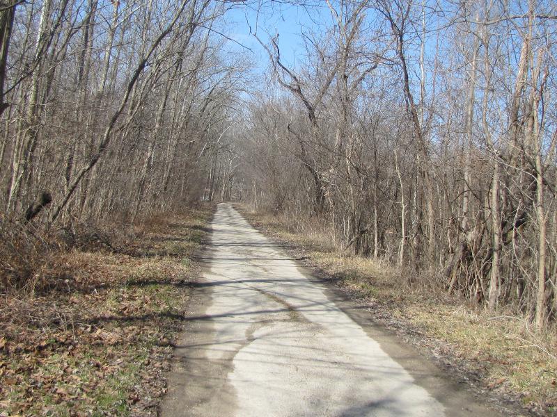
When you travel on US 40, keep your eyes peeled for these old mile posts and for historic information signs. Each state has its own info sign design, the same as each state had its own mile post material.


National Road “modern improvements” in Ohio in 1916

Photo on the Eagles Nest Interpretive Marker showing travel on the National Highway

The Eagle’s Nest monument on the National Road (US 40) was erected around 1916 after a 29 mile stretch of the then unimproved and often nearly impassable road was replaced with concrete. The stretch of highway ran from Zanesville to Hebron and is east of Columbus. It is at the highest elevation of the road in Ohio.

Eagle’s Nest Monument, Interpretive Sign on right

The monument is a large granite rock with some interesting inscriptions carved into the surface. The photos show some of the details of the inscriptions, including a Conestoga wagon and mileage to Cumberland, Maryland, the starting point of the road. The completion of the experimental concrete stretch of the road led to a large parade when it opened.

Conestoga wagon etched into the granite

Ironically the day we stopped here the conditions were very muddy and wet. What a reminder of some of the early muddy conditions that the early travelers faced as they traveled across country.

You are 220 miles from the start of the National Road in Cumberland, MD.

A large interpretive sign was installed next to the monument in 2000. A well attended ceremony was held in a church near the site. You can visit the record of that ceremony here. This page displays the entire interpretive sign and other details.


1916 era monument to National Road “modern imporvements” in Ohio

Photo on the Eagles Nest historic marker showing travel on the National Highway

Photo on the Eagles Nest historic marker showing travel on the National Highway

The Eagles Nest monument on the National Road (US 40) was erected around 1916 after a 29 mile stretch of the then umimproved and often nearly impassable road was replaced with concrete. The stretch of highway ran from Zanesville to Hebron.

The monument is a large granite rock with some interesting inscriptions carved into the surface. The photos show some of the details of the inscriptions, including a Conestoga wagon and mileage to Cumberland, Maryland, the starting point of the road.

The day we stopped here the conditions were very muddy and wet. What a reminder of some of the early muddy conditions that the early travelors faced as they traveled across country.


The Eagles Nest monument

The Eagles Nest monument

Conestoga wagon etched into the granite

Conestoga wagon etched into the granite

You are 220 miles from the start of the National Road in Cumberland, MD.

You are 220 miles from the start of the National Road in Cumberland, MD.

A German WWII Buzz Bomb in Greencastle, Indiana??

As Sher and I were driving west on the National Road (aka US 40) I about drove off the street when we went through Greencastle, a town west of Indianapolis. There mounted on a large concrete “V” shaped base was one of the infamous WWII German terror weapons: a V1 Buzz Bomb. This flying bomb was the first ‘cruise missle’.

Complete with accurate paint colors is the Buzz Bomb on the town square in Greencastle

Complete with accurate paint colors is the Buzz Bomb on the town square in Greencastle

I recognized it immediately and I’m sure I startled Sher when I said “What the heck is that doing here?”

It turns out that the Greencastle requested this relic for the monument they erected to honor those from their county (Putnam) who gave their lives in WWII. There is, according to the plaque, only one other V1 in the states and it is at the Smithsonian in DC.

No Sherman tank or artillery piece for Greencastle. No they have one of the rarest of artifacts from WWII as their memorial. Wow.

Another view

Another view

From the rear

From the rear

The story of the Greencastle V1

The story of the Greencastle V1

World’s largest wind chime

You see some out of the ordinary things on US 40, the National Road. Casey, Illinois has some of those things. The world’s largest wind chimes broiught us to a halt a we drove through this little town. The “coming soon” foundations for the allegeded largest rocking chair was a hoot. I wondered how long the chair has been “coming soon”.

World's largest wind chime

World’s largest wind chime

And it will arrive when??

And it will arrive when??


Travel on the National Road (US 40)

This is a section of the very old road! Watch for the signs which will occasionally lead you to a short stretch like this one.

This is a section of the very old road! Watch for the signs which will occasionally lead you to a short stretch like this one.

Sher and I are traveling on the National Road, aka US 40. We will be sharing photos of some of the things that we “discovered” along the way. Our first leg was eastbound from Richmond Indiana towards Columbus Ohio. We traced from Columbus east for a while and then returned to Indiana for family business.

The last couple of days we traveled west from Indy towards St. Louis. It is a treat to cruise along at 50 mph and really take in the sights. (Saves gas too!)


In Brownville, Ohio you can see one of the remaining original mileage markers.

In Brownville, Ohio you can see one of the remaining original mileage markers.